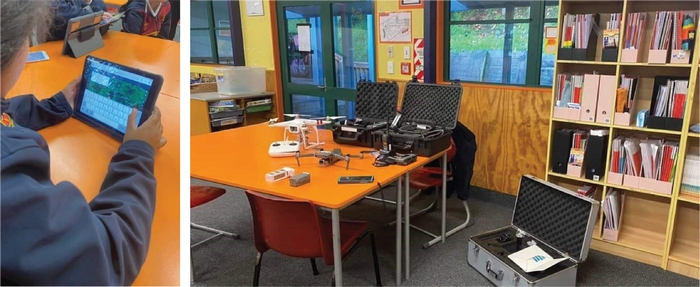
Teaching kids to fly… a drone!
Cherie Rangiahau, a senior forest advisor, conducted an exercise with the year 7 and 8 students of Te Kura Maori o Te Kouto. Exposing the kura kids to drone technology and a little bit of mapping, utilising free open-source software such as Google Earth. The tamariki played around with a DJI Phantom 3 and gave it the name “Matatopa” which means drone in Te Reo. A few remarkable things they have achieved so far is translating Matatopa’s user manual and different drone parts from English to Te Reo.
The exercise aims to give them an awareness of the rules to be followed when operating drones, especially in Rotorua where pretty much anywhere you fly a UAV you will be in controlled airspace, either in the flight path of the commercial aeroplanes landing at the airport, the float planes taking off from the lake itself, rescue helicopters flying into the hospital or the local helicopters operators near the lake. “It was really interesting to see their reactions when I showed videos of what may happen when drones crash into aircrafts and the dangers around Lithium Polymer (LiPo) batteries!” said Ms. Rangiahau.
“My goal is to introduce and expose the kids to the UAV technology as much as possible. Creating an opportunity for the kids to interact with the technology, and possibly lead to an area of interest for them. This could lead them to a career in the field i.e GIS specialists or maybe into coding or programming.” - Cherie Rangiahau, Senior Forest & Landuse Advisor (Ngāherehere me te Whakahaere Whenua) and TFF Committee Member